Big G' ToolZ
Big G' ToolZ is a growing toolkit that takes the pain out of DayZ map making — roads that lay themselves, towns you plan with clicks, forests you paint in zones, and a one-button bake straight into the game.
A real island. A box drawn round it. Fifty-two minutes later I'm driving a car on it in DayZ — the whole pipeline, sped up, with a real-time clock in the corner.
Drop your email and I'll ping you the moment Big G' ToolZ launches — with the founders' price while it lasts.
Two minutes, straight from the toolshed — Big Grampa walks the main tools.
Every tool works on the real thing — your Terrain Builder project, your shapefiles, your heightmap. No exports to learn, no formats to fight.
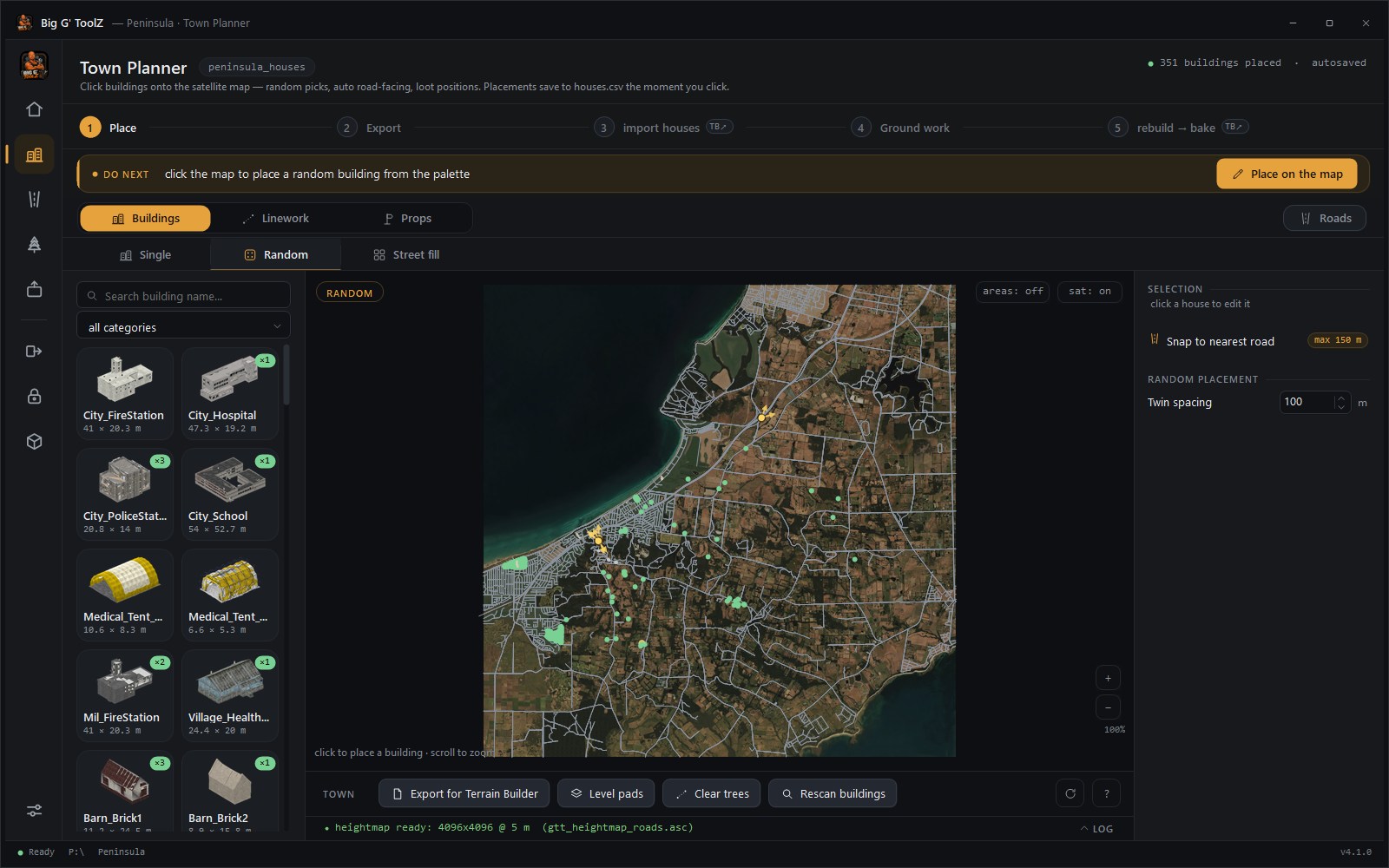
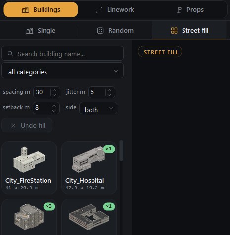
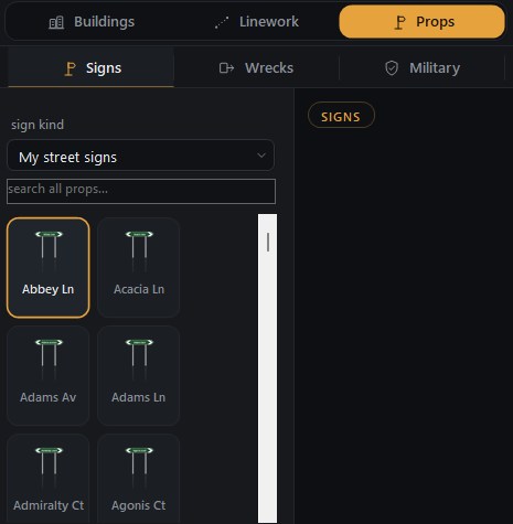
Plan whole towns visually on a 1 m-per-pixel satellite map. Every vanilla DayZ building comes with a real preview rendered from the game model, and drops in already facing the road, already at the right ground height — with loot spawn positions generated for every building you place. Fill whole streets in one pass, draw footpaths and fence lines, drop street signs named after your own roads — and a workflow bar always tells you what to do next. Piers and jetties come straight from OpenStreetMap too: every pier on your coast is laid in the kit you pick, sections chained out from the shore with the head piece at the sea end, seated at sea level whatever the seabed does.
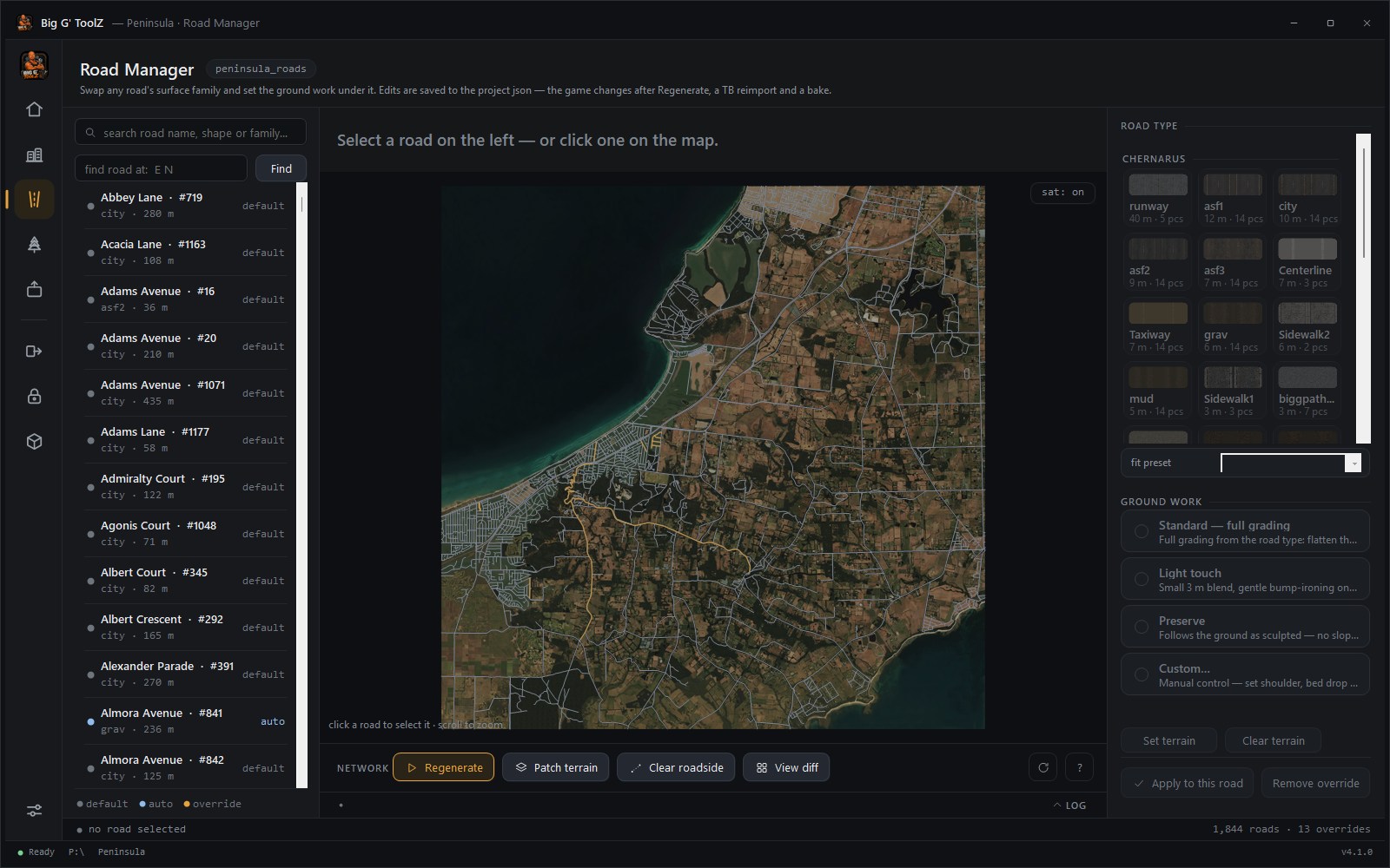
Perfectly mated pieces, smooth corners, clean junctions, tidy end caps. Every road arrives already named and classed from OpenStreetMap — browse them by name, swap the surface — dirt, asphalt, gravel — with one click, and choose how the ground under it is shaped. The terrain is graded under every road for you. Bridges lay themselves: where OpenStreetMap says a road crosses on a bridge, the span gets vanilla bridge decks — metal, stone, concrete or timber to match the surface — and the road on either side meets them clean. No more hand-placing road segments in Terrain Builder.
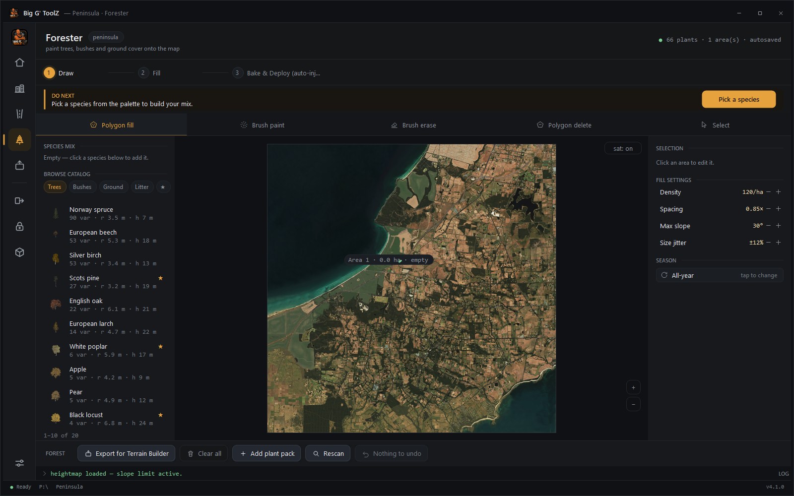
Draw a zone on the map — or tick Import areas and every wood and scrub your map's land cover knows about becomes a planting zone, no tracing. Pick a species mix — 60% spruce, 30% birch, 10% bush — set the density, and fill it with trees. Every species comes with a real preview, scatter respects slope, spacing and keeps off the roads, and zones stay editable: reshape them, re-dial the mix, re-scatter. Brush tools cover the small stuff.
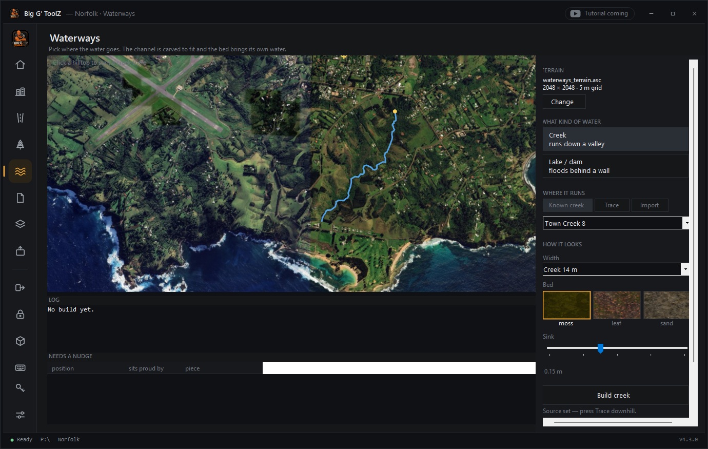
Every stream OpenStreetMap knows about on your map is in the list. Pick one, choose the width and the bed — moss, leaf or sand — and press Build: the channel is carved to fit, the bed and the water pieces seat themselves on it, and trees in the way are cleared. Or click a hilltop and trace a creek of your own. Dams flood the valley behind a wall. Water only ever runs downhill — the solver makes sure of it.
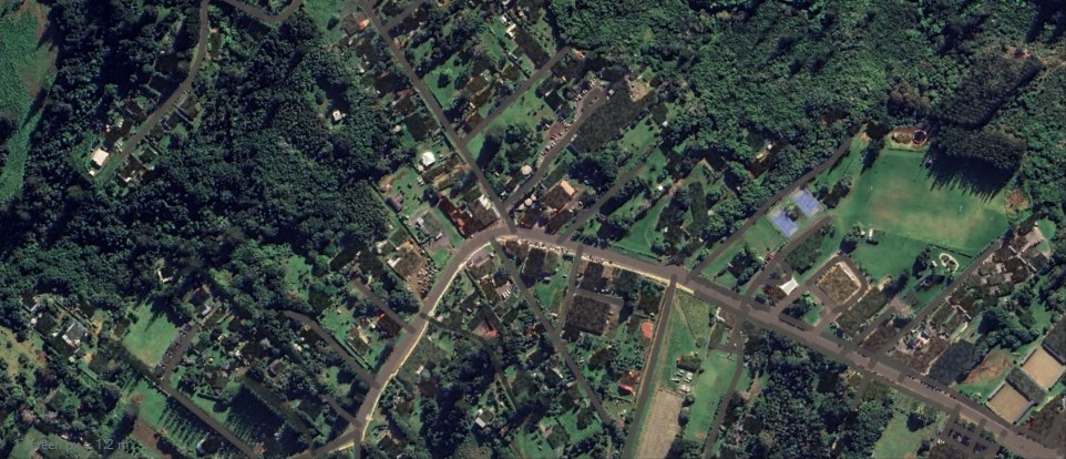
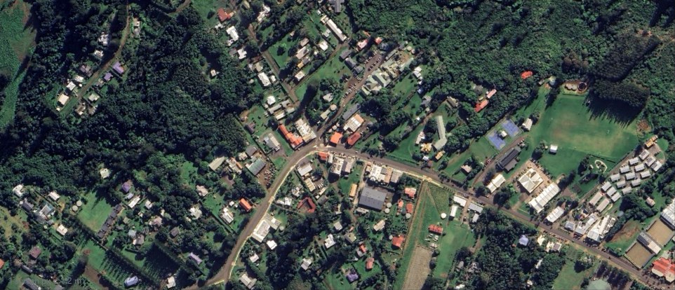
Road pieces vanish at distance; houses stand on a printed roof. Two ticks fix both: every building footprint is erased from the satellite photo and filled with the ground around it, and every road you laid is painted onto the photo at piece width, in the colour the photo itself says roads are. Draw an area for the rest — erase, blur, tint, or fill a blank patch of sea with real water — and restore the untouched photo any time. Drag the handle: the photo as exported, and after two ticks.
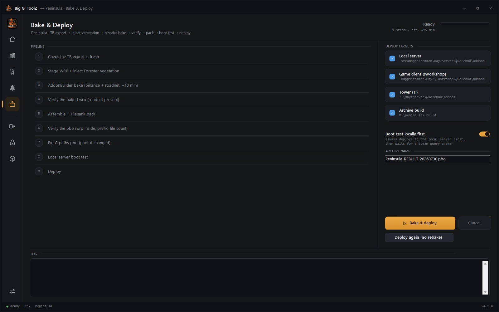
Your roads, trees, creeks and houses go straight into the world file. No importing them into Terrain Builder first — the bake injects everything the tools placed, binarizes, verifies, packs, writes the test mission and server config, boots your map on a local server, deploys, and hands you a Start server / Join game button. Terrain Builder is for looking, not for typing.
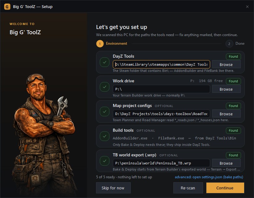
First run scans your PC for DayZ Tools and your work drive — green ticks show what's found, so you fix only what's marked. Type a map name into New Project — from a Big G' Terrain Tools export it finds the shapefiles, heightmap and satmap itself, names every road, and builds its catalogs from your own game data. Keep as many map projects as you like and hop between them with one click.
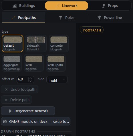
Footpaths that hug the terrain with joints tighter than 1 cm. Draw the line, done.
Fences, stone walls and power lines laid along a drawn line — posts spaced, corners resolved, gates where you want them.
See where the sea stands on your terrain before you bake. Land the game would show as water lights up red; paint it dry, flood a lagoon, or lift every low patch in one click. Slide the tide up to see what a king tide takes.
Street-name blades, road signs and props dropped with a click — auto-faced along the road, at the right height.
Want to see it in Buldozer first? One folder, every file in import order, each row saying which import and which setting.
Move a mod to a new folder or prefix without breaking a single path reference.
Protect your finished PBOs before you release them.
A QGIS plugin that pulls satellite imagery, elevation and OpenStreetMap roads, water, buildings and landuse for any patch of the real world and exports it ready for Terrain Builder — a surface mask from real land cover and tree heights, satmap joins evened out, the sea calmed, and a numbered walkthrough of the Terrain Builder dialog written beside every export.
Yours for nothing — not part of the subscription.
Get the pluginOne subscription, every tool — including the ones that don't exist yet.
Every new tool and every upgrade lands in your copy automatically.
Subscribe once, grow with the kit.
Simple: one price, every tool. Start with a 14-day free trial.
14-day free trial — use everything before you pay a cent.
Big G' ToolZ is in alpha: it has bugs, and the known ones are listed before you buy.
You are buying it as it is today, so there are no change-of-mind refunds — the free
trial is there so you can be sure first. Cancel anytime and you will not be charged again.
All prices in US dollars. Nothing here affects your rights under the
Australian Consumer Law.
The questions map makers actually ask.
Nothing. Everything you build — terrains, roads, shapefiles, layers — is standard DayZ project data saved on your PC. It's yours forever. Only the tools stop opening; your work is never held hostage.
Yes. Every tool added to Big G' ToolZ while you're subscribed is included at no extra cost. That's the whole point of the subscription.
Your license key works on up to 2 PCs (e.g. desktop + laptop). You can deactivate an old machine yourself anytime.
Only occasionally. The tools check your license when they can and keep working offline for up to 7 days between checks.
Windows 10/11 and the free DayZ Tools from Steam. If you can run Terrain Builder, you can run Big G' ToolZ.
No change-of-mind refunds. Big G' ToolZ is in alpha — it has bugs, and the known ones are listed before you buy. The 14-day free trial is there so you can be certain it fits your workflow before you pay anything, and you can cancel any time so you are never charged again. Nothing here affects your rights under the Australian Consumer Law.
The Big G' ToolZ Discord — a direct line to the developer and a community of map makers. The invite comes with your license.